Purpose of the project: The primary purpose of the project was to restore fish passage and winter rearing habitat for coho salmon and other native fish on 31 acres of the Sixes River estuarine floodplain at Cape Blanco State Park. Coho salmon are listed as threatened in the Sixes River watershed, and winter rearing habitat is the primary limiting factor to their recovery. Other objectives included: the restoration of wetland habitat for shorebirds and amphibians; enhancement of wildlife habitat for migratory songbirds, small mammals, and elk; and improved livestock management on pasture leased to a local ranching family who raises cattle and sheep. The restoration project was developed by a group of local Stakeholders that included state and federal agencies, the local watershed council and soil and water conservation district, the Coquille Indian Tribe, and the McKenzie Family who leases pastureland from the Park. The Stakeholders saw the project as a great opportunity to demonstrate how watershed restoration and “working lands” (the family ranch) can co-exist on the landscape, and collectively contribute to the heritage and economy of the local community.
Purpose of the project:
The primary purpose of the project was to restore fish passage and winter rearing habitat for coho salmon and other native fish on 31 acres of the Sixes River estuarine floodplain at Cape Blanco State Park. Coho salmon are listed as threatened in the Sixes River watershed, and winter rearing habitat is the primary limiting factor to their recovery. Other objectives included: the restoration of wetland habitat for shorebirds and amphibians; enhancement of wildlife habitat for migratory songbirds, small mammals, and elk; and improved livestock management on pasture leased to a local ranching family who raises cattle and sheep.
Conservation Success:
• The restoration of fish passage to ~200 acres of winter rearing habitat
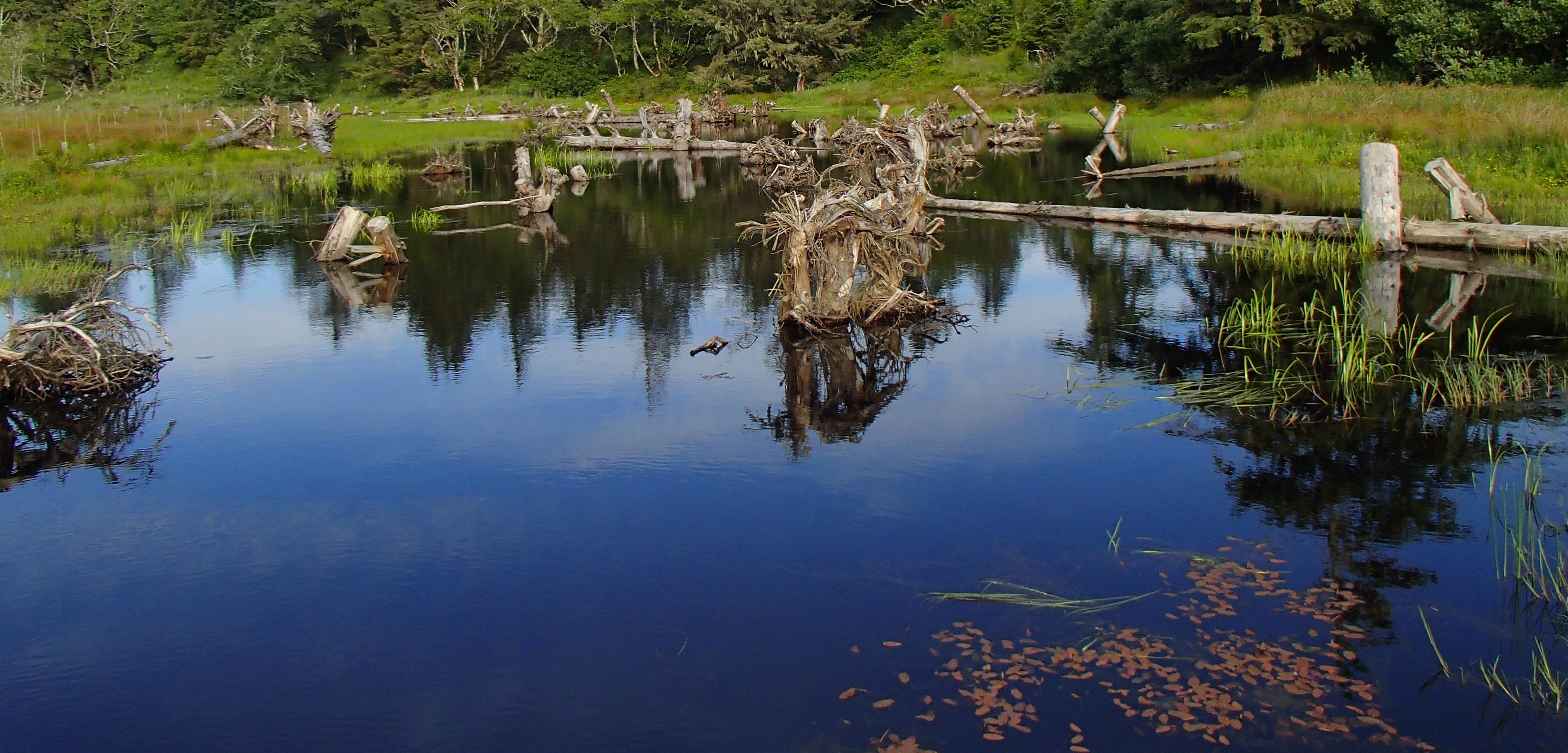
• The replacement of 1,000 feet of deeply incised ditch channel with 2,600 feet of unconfined, constructed stream channel
• The excavation of 2 acres of backwater rearing habitat
• Hydrologic reconnection of 11.25 acres of wetland habitat
• The installation of 143 log structures
• The construction of 2 livestock management bridges
• The construction of 9,000 feet of fence to exclude livestock from 31 acres of riparian and wetland habitat
• The planting of ~22,000 native trees and shrubs
• Improved livestock management on 8 acres of pasture
Human Interest/Community Benefit:
Cape Blanco State Park is a highly popular recreation site for local residents and regional and international tourists that provides access to the Pacific Ocean and the Elk River and Sixes River estuaries. The Park is used by anglers, campers, hikers, boaters, birders, bikers, botanists, sightseers, historians, and horseback riders. The entrance road to the Park crosses through the Sullivan Gulch Bottomlands, and the project area is highly visible from the road and accessible by foot.
The restoration project was developed by a group of local Stakeholders that included state and federal agencies, the local watershed council and soil and water conservation district, the Coquille Indian Tribe, and the McKenzie Family who leases pastureland from the Park. The Stakeholders saw the project as a great opportunity to demonstrate how watershed restoration and “working lands” (the family ranch) can co-exist on the landscape, and collectively contribute to the heritage and economy of the local community.
The project has been featured in local newspapers and newsletters, and multiple tours have been given to community groups and the public. School children from multiple districts in the county participated in the first year of tree planting, and local volunteers have assisted with bird counts.
Project Timeline: The project was constructed in the summer of 2015 and fenced and planted in the winter of 2016. Tree and shrub maintenance, interplanting, and invasive weed suppression are ongoing through 2020; as is monitoring to determine project effectiveness and future management needs.
Partners: The following partners were involved in the development, implementation, and/or funding of the project:
• Bureau of Land Management
• Coquille Indian Tribe
• Curry Soil and Water Conservation District
• USDA Farm Services Agency
• McKenzie Family
• North American Wetland Conservation Act
• Oregon Department of Fish and Wildlife
• Oregon Parks and Recreation Department
• Oregon Watershed Enhancement Board
• Pacific Marine and Estuarine Partnership
• South Coast Watershed Council
• US Fish and Wildlife Service
• US Forest Service
• Wild Rivers Coast Alliance