Lake Bloomington is located in central Illinois about 160 miles northeast of St. Louis and approximately 125 miles southwest of Chicago. It was constructed in 1929 by the impoundment of Money Creek. Lake Bloomington, as of 2007, has a surface area of 572 acres, 9.5 miles of shoreline, a maximum depth of 35 feet, a mean depth of 12.9 feet, and a storage volume of 6768 acre feet. The lake was constructed to expand the water supply for the City of Bloomington and several other small communities. To fully utilize the lake’s potential, recreation and residential development were established as second and third priority uses, respectively. The lake supports a diverse group of users including Camp Pearis, a Girl Scout Camp which houses over 1300 scouts during the summer and the Easter Seals Rehabilitation Center which serves over 1500 children with special needs annually.
Lake Bloomington is located in central Illinois about 160 miles northeast of St. Louis and approximately 125 miles southwest of Chicago. It was constructed in 1929 by the impoundment of Money Creek. Lake Bloomington, as of 2007, has a surface area of 572 acres, 9.5 miles of shoreline, a maximum depth of 35 feet, a mean depth of 12.9 feet, and a storage volume of 6768 acre feet. The lake was constructed to expand the water supply for the City of Bloomington and several other small communities. To fully utilize the lake’s potential, recreation and residential development were established as second and third priority uses, respectively. The lake supports a diverse group of users including Camp Pearis, a Girl Scout Camp which houses over 1300 scouts during the summer and the Easter Seals Rehabilitation Center which serves over 1500 children with special needs annually.
The primary impairments in Lake Bloomington are high levels of phosphorus and nitrates/nitrites, sedimentation, and lack of quality fish habitat. Under Section 303(d) of the Clean Water Act, the State of Illinois declared that Lake Bloomington did not meet state water quality standards because of excessive nitrates and phosphorous and placed it on Illinois’ list of impaired waters in 2006. The Lake Bloomington Watershed Plan (http://web.extension.illinois.edu/lmw/downloads/22860.pdf) discusses the issues facing Lake Bloomington and its watershed and also proposes solutions to address the issues. An estimated 106,800 tons of erosion occurs on an annual basis from the six major types of soil erosion within the Lake Bloomington watershed. Approximately 29,900 tons of suspended and bedload sediment is actually “delivered” to the lake on a yearly basis. After the 1958 increase in dam elevation, Lake Bloomington held 7352 acre/feet of water. Since then 33% of the volume of the lake has been lost due to sedimentation. Overall, 2436 acre/feet of sediment has entered the lake, with the average of 0.4% loss annually. As part of the watershed management plan, Best Management Practices have been implemented to address streambank and lakeshore erosion, destratification, agricultural practices to limit runoff, wetland development, limiting urban runoff, and septic inspection and replacement.
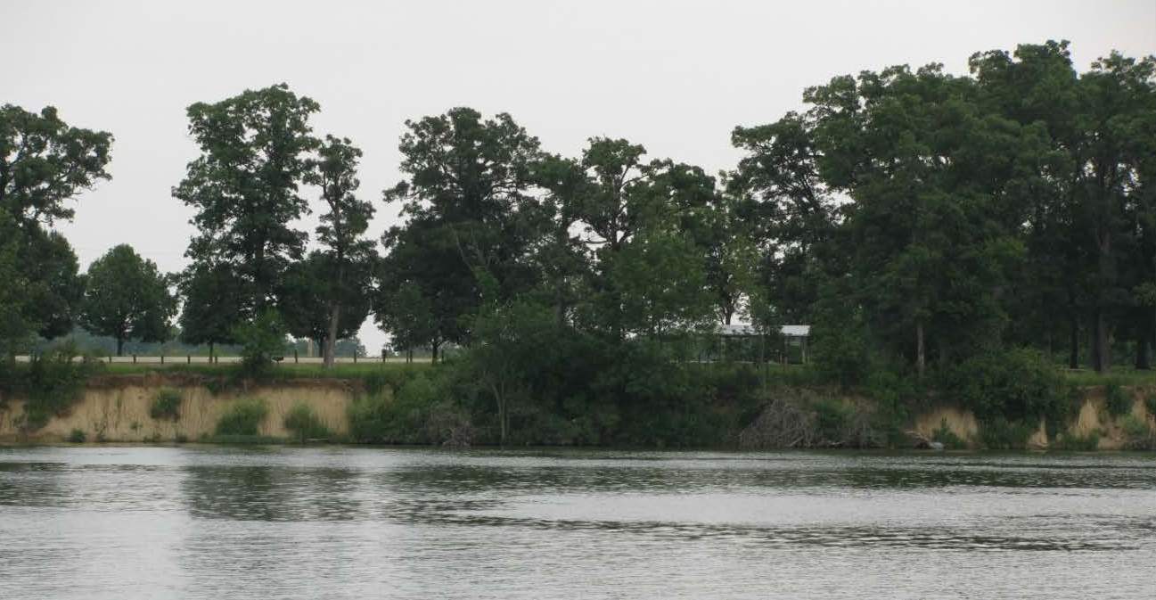
The Reservoir Fisheries Habitat Partnership is partnering with the Friends of EverBloom (a Friends of Reservoirs Chapter), Illinois Department of Natural Resources, the City of Bloomington, McLean County Soil and Water Conservation District, McLean County Parks and Recreation and local vendors to rehabilitate a severely eroded shoreline on Lake Bloomington. Lake Bloomington has 55,580 feet of shoreline. Three shoreline erosion surveys have been completed in the past 20 years. Shoreline erosion is reported to be 3756 tons annually, with nearly 60% or 2247 tons coming from the most erodible banks. By concentration on the most highly erodible sites, nearly 60% of the sediment can be stopped by treating only 12% of the shoreline at an estimated cost of $340,000. If taken over the expected 50 year life of the shoreline protection the cost per ton of soil is only $3.03, while other less severely eroding sites have per ton cost 2 to 18 times higher. Due to the steep, high banks, and extreme fluctuations in water levels, biotechnical means of shoreline stabilization were excluded from consideration.
The recommended alternative, based upon cost and impact upon near shore woodland cover is Stone Toe Protection (STP) which when applied along the eroding sections will provide the stability needed to protect the base of the bank and prevent any additional recession of the bank line. The STP will be placed at a distance from the eroding bank to allow for a 2:l slope and vegetated by balancing the cuts and fills so that no material need be transported to or from the site. The use of STP places the maximum volume of stone at the base of the slope where erosion is most severe. This provides additional safety and effectiveness to the use of STP as there is sufficient stone to launch into any area that may erode on the lake side of the STP and still maintain protection of the shoreline.
The project site is approximately 950 feet of shoreline located in a city park and adjacent to a boat ramp. Artificial structure in the form of tile culverts will be incorporated into the rip rap to provide cover for catfish, walleye, and largemouth bass. IL DNR has conducted fisheries surveys at this site for the past 15 years and has found the site to be devoid of both numbers and diversity of fish. Bank stabilization and additional fish structure will increase fish community diversity at this site and provide easy access for anglers.
IL DNR staff will continue to monitor the fish community following the completion of the project. The City of Bloomington regularly collects water samples to determine dissolved oxygen, temperature, pH, and phycocyanin profiles. Total and volatile suspended solids, total phosphorus, chlorophyll and phytoplankton samples are also collected. The City is contracting with Illinois State University to perform a bathymetric/sedimentation survey to compare the results from the survey completed in 1999. The ultimate goal of the rehabilitation efforts is to remove Lake Bloomington from Illinois’ list of impaired waters.
Local outreach efforts will include signage at the project site, regular meetings of The Friends of Everbloom to keep members and the public informed of this and other projects on Lake Bloomington. The Friends of Everbloom will also use their web page (http://friendsofeverbloom.weebly.com/) to publicize the project. The local newspaper, The Pantagraph, has an outdoor writer who currently is the Friends of Everbloom president and regularly writes about projects on the lake. In addition, The Reservoir Fisheries Habitat Partnership will use its media contacts and outlets to inform the public of this and other important reservoir fisheries habitat enhancement efforts around the country.
Partners:
Friends of EverBloom (a Friends of Reservoirs Chapter), Illinois Department of Natural Resources, the City of Bloomington, McLean County Soil and Water Conservation District, McLean County Parks and Recreation