Both Deer and Mill creeks are considered conservation strongholds for this ESU, as well as Central Valley steelhead (O. mykiss), which are listed as threatened under the Federal Endangered Species Act, and fall-run Chinook salmon, listed as a State Species of Special Concern. The Final Central Valley Chinook Salmon and Steelhead Recovery Plan identifies Deer and Mill creeks as top priority watersheds for the recovery of Central Valley spring-run Chinook salmon and Central Valley steelhead (National Marine Fisheries Service (NMFS 2014). Improving fish passage on both creeks is vital to the overall health and recovery of Chinook salmon and steelhead in California’s Central Valley.
Purpose of the project(s):
Chinook salmon and steelhead are part California’s natural heritage, and their recovery and preservation for future generations presents both a challenge and an opportunity. Meeting that challenge requires that Deer Creek and Mill Creek, in Tehama County, are restored to their full potential as streams that have been home to salmonids for thousands of years. Deer and Mill creeks are two of only three streams supporting extant self-sustaining wild populations of Central Valley spring-run Chinook salmon (Oncorhynchus tshawytscha). The Central Valley spring-run Chinook salmon Evolutionarily Significant Unit (ESU) is listed as threatened under the State and Federal Endangered Species Acts. Both Deer and Mill creeks are considered conservation strongholds for this ESU, as well as Central Valley steelhead (O. mykiss), which are listed as threatened under the Federal Endangered Species Act, and fall-run Chinook salmon, listed as a State Species of Special Concern. The Final Central Valley Chinook Salmon and Steelhead Recovery Plan identifies Deer and Mill creeks as top priority watersheds for the recovery of Central Valley spring-run Chinook salmon and Central Valley steelhead (National Marine Fisheries Service (NMFS 2014). Improving fish passage on both creeks is vital to the overall health and recovery of Chinook salmon and steelhead in California’s Central Valley.
Successful survival and recruitment of salmonids requires freshwater migration corridors thatfunction sufficiently to provide adequate passage. For this reason, freshwater migration corridors are considered to have a high conservation value and are ofutmost priority for restoration in Mill and Deer Creek watersheds within this critical decade.
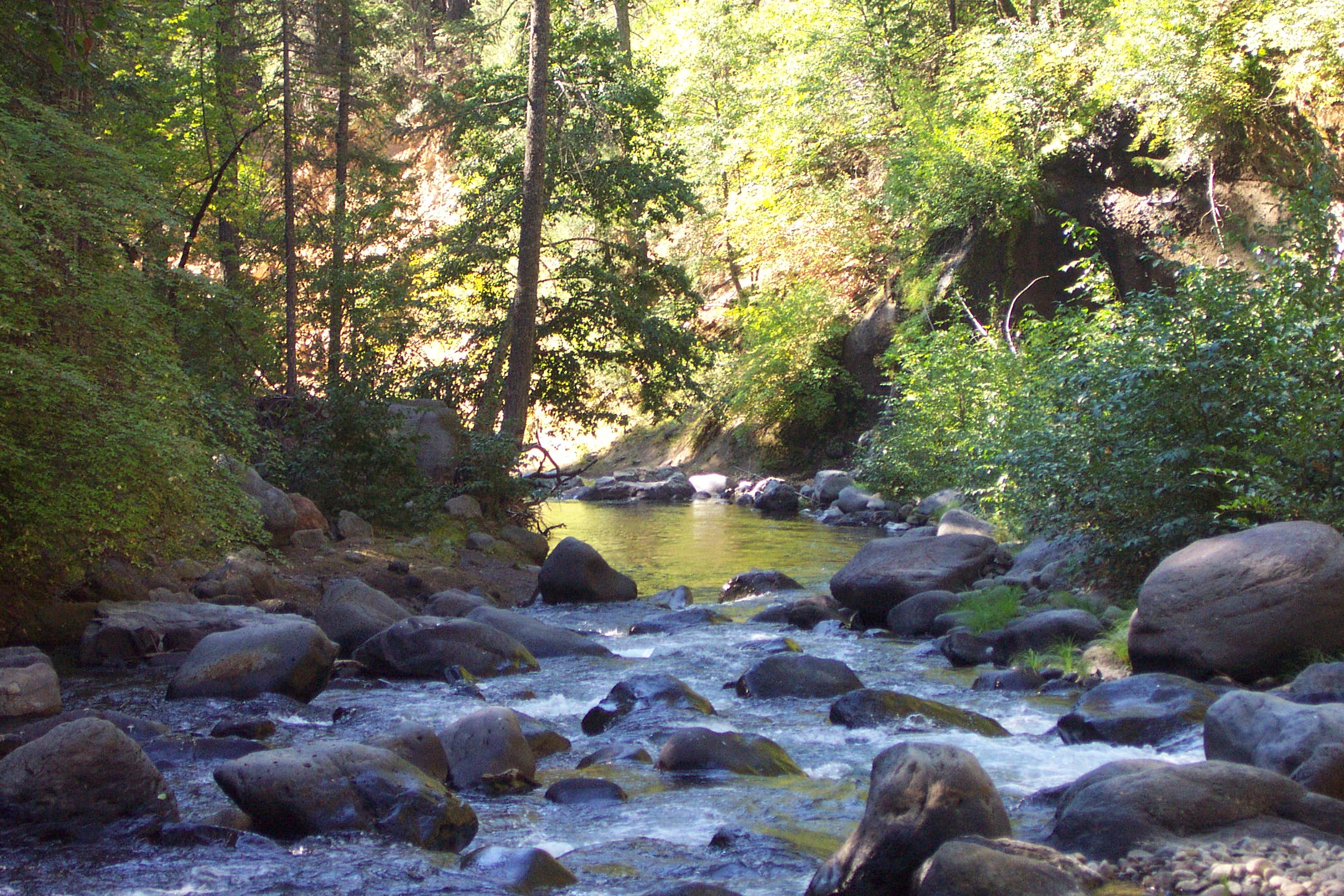
Deer Creek is a Northern Sierra Nevada Mountain tributary that flows southwesterly to the Sacramento River for about 60 miles, draining 134 square miles. Deer Creek originates near the summit of Butt Mountain at an elevation of about 7,320 feet. It initially flows through meadows and dense forests and then descends rapidly through a steep rock canyon into the Sacramento Valley. Upon emerging from the canyon, the creek flows 11 miles across the Sacramento Valley floor, entering the Sacramento River at about 1 mile west of the town of Vina at an elevation of about 180 feet.
Mill Creek originates on the southern slopes of Lassen Peak at an approximate elevation of 8,000 feet. It flows to its confluence with the Sacramento River at an approximate elevation of 200 feet, adjacent to the unincorporated community of Los Molinos. The watershed drains about 134 square miles through a stream length of about 60 miles. The stream has several unique features that include its course through steep-sided canyons. These make Mill Creek relatively inaccessible in the upper watershed and provide some of the highest elevation-spawning habitat for Chinook salmon known in North America.
Deer Creek
Current Priority Actions in Deer Creek include:
Modify the fish passage facilities to modern standards at Stanford-Vina Ranch Irrigation Company Diversion Dam, the Deer Creek Irrigation District Diversion Dam, the Cone-Kimball Diversion Dam, and at Lower Deer Creek Falls in order to provide unimpeded passage for adult and juvenile Chinook salmon and steelhead to their upstream spawning and rearing habitat.
Develop and implement instream flow agreements with the Deer Creek Irrigation District, the Stanford-Vina Ranch Irrigation Company to provide flows that best support all life stages of spring-run Chinook salmon and steelhead.
Active Restoration Projects in Deer Creek:
Lower Deer Creek Falls: The U.S. Fish and Wildlife Service (USFWS) and the California Department of Fish and Wildlife (CDFW) are co-funding an upgrade to a fish passage structure on Deer Creek located on private property in eastern Tehama County at a site known as Lower Deer Creek Falls. The purpose of the action is to improve upstream and downstream passage conditions for Chinook salmon, steelhead and other aquatic fish and wildlife species. The current concrete fish passage structure adjacent to the falls inhibits the movement of salmon and steelhead into the upper watershed. The proposed action was developed in cooperation with the willing landowner and the U.S. Forest Service and involves the removal and replacement of the existing fish passage structure. Construction is expected to occur in summer 2016.
Deer Creek Irrigation District Dam: This project will construct channel and habitat modifications below the diversion dam operated by the Deer Creek Irrigation District (DCID) on Deer Creek approximately 12 miles upstream of the Sacramento River. The project is the culmination of multi-year collaborative efforts involving DCID, CDFW, the California Department of Water Resources (DWR), USFWS, NMFS, and Trout Unlimited. When completed, the project will remedy a major element of the fish passage issues in lower Deer Creek that have been identified as the most important limiting factor affecting spring-run Chinook salmon and Central Valley steelhead in the watershed.
The existing DCID diversion on Deer Creek includes a concrete dam, diversion canal entrance on the left bank upstream of the dam, in-canal fish screens, and an in-canal flume to measure diversion flow. The concrete dam is about 3 feet high across much of the channel however, flashboards are typically installed along the dam crest to provide adequate head to provide DCID diversion flows. The restoration project includes constructing a roughened rock ramp downstream of the existing dam, re-profiling the upstream 1,100 feet of the diversion canal, adjusting the existing fish screens to account for the diversion canal reprofile, and replacing the existing flume with a low head loss flow monitoring device. The roughened rock ramp will improve hydraulic conditions at the site to meet fish passage criteria. Re-profiling the diversion canal and replacing the flume will reduce the head needed at the diversion dam to provide diversion flows. The roughened rock ramp will provide adequate head at the diversion take-off to meet diversion needs in the re-profiled canal negating the need for flashboards to be installed. Based on preliminary discussions with DCID, the diversion dam could later be removed as a separate project once the performance of the rock ramp to meet diversion needs is verified. If funding through pending grant program applications is awarded, the project is slated for construction in summer 2018.
Mill Creek
Current Priority Actions
in Mill Creek include:
Dam and Ward Dam.
Implement fish passage improvement projects at the Los Molinos Mutual Water Company (LMMWC) Upper
Improve instream flow conditions during migration periods through cooperative efforts with landowners, LMMWC, and water right holders.
Active Projects in Mill Creek:
Ward Diversion Dam: This project was initiated in 2015 and is located on a privately owned working organic cattle ranch referred to as the “Mill Creek Ranch.” Ward Dam is part of a private stream diversion system that supplies irrigation water for agricultural and residential uses. Ward Dam is located about 1.25 miles upstream of the Shasta Boulevard Bridge and about 4,000 feet downstream of another diversion dam on Mill Creek referred to as the “Upper Dam”. The elevation of Ward Dam is approximately 291 feet. It is in a wide section of Mill Creek where the south channel bank is above the 100-year water surface elevation. The dam has been in place for at least 50 years and it has impounded coarse sediment up to an elevation of about 290 feet behind the dam crest. The purpose of the proposed project is to improve upstream and downstream passage for anadromous fish and other native aquatic species in Mill Creek. The upgrades and modifications to the fish ladder, fish screen, and water diversion infrastructure provide improved passage for adult migration upstream and juvenile migration downstream of Ward Dam. This project was constructed in summer/fall 2015; final restoration actions (such as replanting riparian areas disturbed by project activity) are underway in spring 2016.
Upper Dam: Upper Dam is located on Mill Creek about 5.4 miles upstream of its confluence with the Sacramento River, and about 2.5 miles upstream of LMMWC’s diversion facility at Ward Dam. The dam is located in a straight section of canyon with little to no floodplain. Upper Dam is a concrete
structure with a crest that is about 55 feet wide at an elevation of 380.0 feet. The concrete dam face slopes at about 25% to an elevation of 375.9 feet over a distance of about 20 feet. A 10-foot wide sluice gate is located in line with the dam on the right bank. An abandoned on-channel fish screens structure is
used as a trash rack, although the top elevation of the structure is only about 2.5 feet above the dam crest. The fish ladder is a concrete pool weir fish ladder with 3 pools and 4 weirs. The structure is about 8 feet wide (including walls) and 25 feet long. Northwest Hydraulic Consultants, a private consulting
firm, determined the ladder did not meet CDFW and NMFS criteria for the full range of fish passage flows. The primary deficiencies include inadequate freeboard on the fishway walls, and inadequate pool volume for energy dissipation. The proposed design will replace the existing fishway with a wider and longer half chute-and-pool fishway. The fish screen facility will be at an on-canal location about 50 feet downstream of the dam. The juvenile bypass pipe will be buried under the existing canal and extend about 300 feet downstream of the fish screens before exiting back into Mill Creek. The diversion channel will extend further upstream with a fish fence placed across the channel entrance to help prevent entrainment of adult salmonids. As of spring 2016, 100% designs are nearly complete, as are environmental documents and permits. However, funding is not yet in place for construction, so the construction date is unknown.
Human Interest/Community Benefit: Chinook salmon are an iconic species in California. Spring-run Chinook salmon endure in the Central Valley, where they must migrate hundreds of miles of degraded habitat conditions and ascend into high elevation streams to reach their natal grounds, a true testimony to the persistence of a cornerstone of California culture. The prospect of restoring to greatness, the last remaining populations of Central Valley spring-run Chinook salmon, is an opportunity that well captures the attention of not just the local community, but the entire State of
California. Success of this endeavor will enable many interest groups to protect rare and iconic species, preserve unique watersheds, and foster partnerships that span water use, agricultural, and environmental issues.
The Sacramento River Basin is the largest river basin in California, covering 27,000 square miles with about 31% of the state’s total annual surface water runoff. The Sacramento River and its contributing watershed areas are vital to the state’s economy, provide drinking water for residents of two-thirds of the state, and required habitat for many hundreds of fish and wildlife species. From the mountains to the valley, small towns and large cities, it is the place many Californians live, work, and play.*
The Sacramento River is the dominant source of fresh water critical to the long-term health of its watershed and the San Francisco Bay and Delta ecosystems.
It provides nearly all of the water for the State and federal water projects.
The major land uses in the watershed are forestry, agriculture, urban settlement, mining, and recreation.
The watershed’s urban population is projected to double over the next 50 years.
Two million acres, about 12 percent of the watershed, are currently irrigated, producing economically significant yields of rice, fruits, nuts, alfalfa, grain, and tomatoes.
Its rivers and streams support a multitude of important resident and anadromous fisheries.
It also supports numerous additional beneficial uses, including local drinking and industrial water supplies, wildlife habitat, and recreation.*
*Excerpted from the Sacramento River Watershed Program
Project Timeline:
Deer Creek:
Lower Deer
Creek Falls Fishway Improvement Project: July 1–September 30, 2016.
Deer Creek
Irrigation District Fishway Improvement Project: Funding needed. July 1–September 30, 2018, provided that pending grant applications are selected and funds are awarded.
Standford Vina Ranch Fishway Improvement Project: Funding needed. July 1–September 30, 2018, provided that funding is obtained.
Mill Creek:
Upper Dam Fishway Improvement Project: Funding needed. If funding is obtained this summer, construction could occur in 2017.
Partners:
Deer
Creek:
USFWS,
NMFS, U.S.
Bureau of Reclamation (Reclamation),
CDFW,
and the Northern California Regional Land Trust
Mill Creek:
USFWS,
private landowners,
Mill Creek Fish Passage
Restoration Project Technical Advisory Committee (TAC), comprised of
representatives from USFWS, NMFS, Reclamation, CDFW, DWR, Mill Creek
Conservancy, LMMWC, multiple private landowners and several private consulting
firms.
Updates (Completed in August and December):
Best weeks for site
visits: June–October